
Mun Peak Expedition
Summarize this with AI
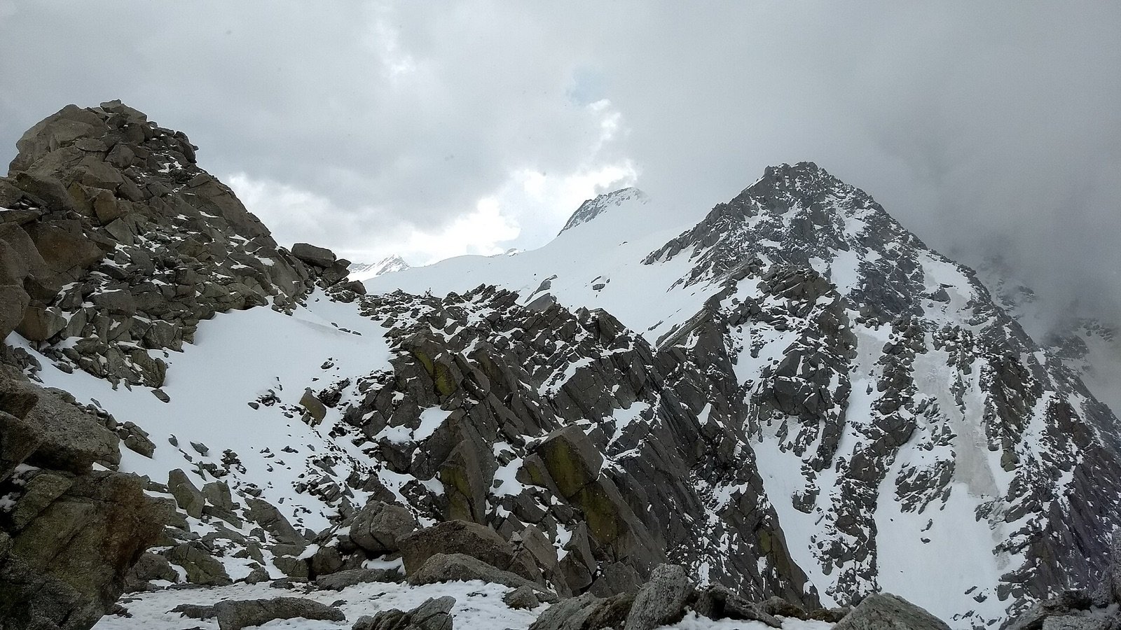
Photo: Vivek machra / CC BY-SA 4.0, via Wikimedia Commons
Overview
A summit push to the highest point above Dharamshala: 4,633 m on the Dhauladhar crest, reached over boulder ridges beyond Indrahar Pass.
Dhauladhar means, straightforwardly, the White Range: dhaula for white, dhar for ridge. Seen from the Kangra valley in winter the name explains itself.
The Dhauladhar is a front range: it rises straight off the Kangra plains with no foothills to soften it, climbing from roughly 800 m to over 4,500 m in about 20 kilometres of horizontal distance. That is why the wall looks so improbably steep from below, and why the views open so abruptly once you gain the ridge. Mun Peak is the highest point on that wall directly above Dharamshala, which is why the summit view runs uninterrupted from the plains to the inner Himalaya.
The peak appears on maps and in local use as both Mun Peak and Moon Peak. The two names refer to the same summit.
Highlights
- The summit of Mun Peak, the highest point on the Dhauladhar wall directly above Dharamshala
- An uninterrupted view running from the Kangra plains to the inner Himalayan ranges
- A genuine expedition-grade climb, not a walk-up — technical sections above the snowline
- High camp under the summit ridge, one of the highest campsites in this range
- The full Dhauladhar "White Range" profile visible in a single sweep from the top
Conditions
Dhauladhar weather turns fast. Carry layers, rain shell and sturdy boots.
What's included
- Certified expedition leader, climbing guides and support staff
- All meals on the trail (veg, fresh-cooked)
- Camping, sleeping and technical climbing equipment (rope, harness, helmet)
- First-aid kit, oxygen support and emergency evacuation plan
- Forest, camping and climbing permits
- Travel to and from Dharamshala
- Personal trekking and cold-weather gear (shoes, backpack, gloves, etc.)
- Travel and high-altitude/medical insurance
- Mule or porter for personal luggage
- Any meals outside the itinerary
Route stages
| Stage | Distance | Altitude | Time |
|---|---|---|---|
| 1McLeod Ganj → Triund ridge | 9 km | 2,875 m | 4–5 h |
| 2Triund → Laka Got | 4 km | 3,200 m | 2 h |
| 3Laka Got → high camp | 3 km | 3,900 m | 3–4 h |
| 4High camp → Mun Peak summit | 4 km | 4,633 m | 4–6 h |
| 5Descent to Triund | 11 km | — | 5–6 h |
Best time to go
| Month | Conditions | Status |
|---|---|---|
| January–March | Deep snow on the pass | Closed |
| April | Snow lingering above 3,500 m | Limited |
| May–June | Pass usually clear, settled weather | Best |
| July–August | Monsoon, with rockfall risk and poor visibility | Avoid |
| September–October | Clearest and most stable conditions | Best |
| November | Early snow closes the pass | Limited |
| December | Impassable without mountaineering equipment | Closed |
Getting there
- By air
- Gaggal / Kangra Airport (DHM), about 15 km from Dharamshala. Direct flights from Delhi take roughly 1 hour 30 minutes.
- By rail
- Pathankot is the nearest broad-gauge railhead, about 90 km away. Onward by road takes roughly 3 hours.
- By road
- Delhi to Dharamshala is about 480 km, 10 to 12 hours by overnight bus. Chandigarh is about 250 km, roughly 6 hours.
- Trailhead
- Galu Devi temple above Dharamkot, about 30 minutes by taxi from McLeod Ganj. Most groups walk in from McLeod Ganj instead.
Frequently asked questions
- How high is Mun Peak?
- 4,633 metres (about 15,200 ft), making it the highest of the peaks directly above Dharamshala. It is also written as Moon Peak.
- Is Mun Peak a technical climb?
- It is a non-technical summit in good conditions, but it involves steep slopes, boulder-strewn ridges and, in season, snow and narrow ground. It is a trek rather than a climb, at the hard end of trekking.
- What experience do I need?
- Previous high-altitude trekking and the fitness to walk 6 to 8 hours a day on steep, rocky terrain. This is not a suitable first Himalayan trek.
- How is the summit reached?
- The ridge is gained from the Triund–Laka–Indrahar side, following the crest to the final summit slopes.
- When is the best season?
- June to early October, once the winter snow has consolidated or cleared from the summit ridge.
Nearby
- Bhagsunag Falls and temple, 2 km from McLeod Ganj
- Namgyal Monastery and the Dalai Lama temple, 1 km, McLeod Ganj
- Naddi viewpoint, for sunset over the Dhauladhar, 4 km
- Dal Lake, Dharamshala, 5 km
- Norbulingka Institute, Tibetan arts, 12 km
- Kangra Fort, 22 km
- Masroor Rock Cut Temples, 45 km
Description Content
Mun Peak, also written Moon Peak, is the highest summit directly above Dharamshala, at 4,633 metres (roughly 15,200 ft). It is the peak you are looking at from the Triund ridge, and standing on it is the logical conclusion of a season spent walking in the Dhauladhar.
The route
The approach shares its lower stages with the Indrahar Pass trek: McLeod Ganj, Triund, and up past Laka toward the crest. From high on that ridge the route continues along boulder-strewn ground to the final summit slopes. Total distance is around 30 km across the itinerary, with the summit day the longest and highest.
What the summit gives you
The Dhauladhar is a front range: it rises straight off the plains with nothing in front of it. From the top of Mun Peak that geography is obvious: the Kangra valley lies more than three vertical kilometres below on one side, and range after range of the inner Himalaya stack up to the north on the other.
Difficulty and fitness
Graded moderate to difficult and the most demanding summit we offer in the range. Expect steep slopes, unstable boulder ridges and, depending on the month, snow or narrow exposed sections. Trekkers need previous high-altitude days and the stamina for 6 to 8 hours of walking on rough ground.
Conditions
Summit days start very early. Afternoon cloud builds fast against the front of the range and the summit ridge is no place to be caught in poor visibility. Turnaround times are set before the group leaves camp and are held to.
Gallery